We're excited to announce that we've undergone a complete website redesign to enhance your browsing experience! Our fresh new look is designed to make navigation easier and content more accessible. Click here to be taken to the new OSPO homepage. Should you have any questions please reach out to the OSPO Webmaster.
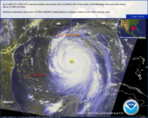
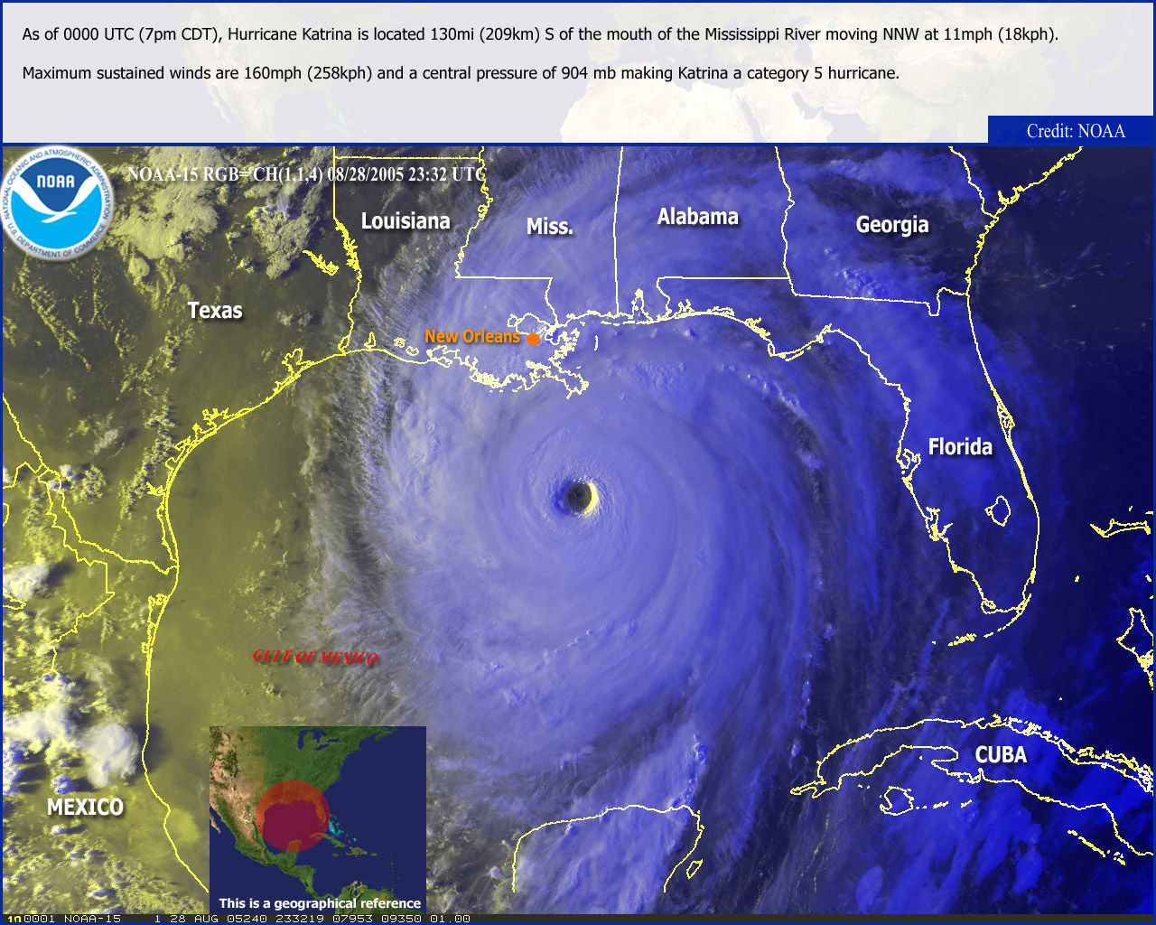
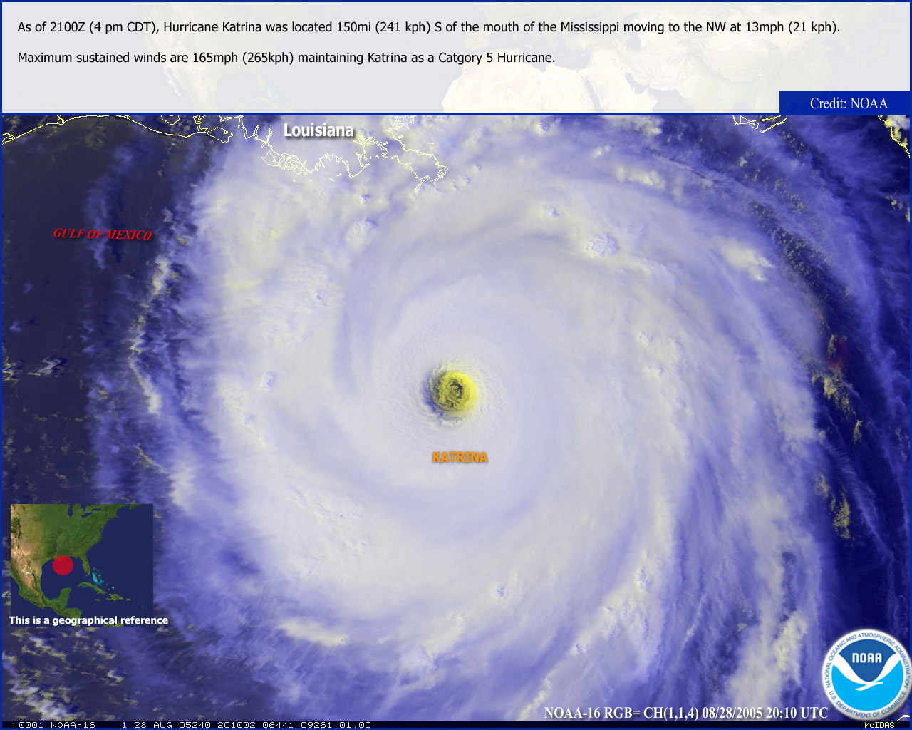
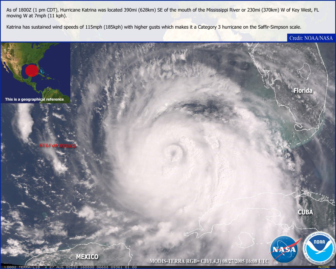
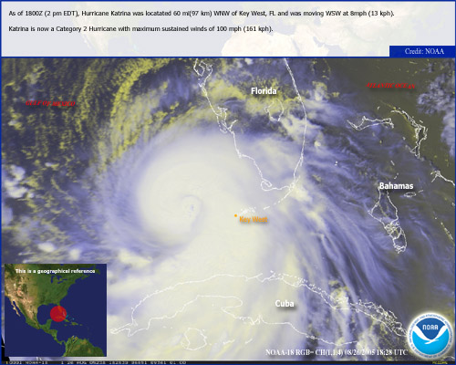
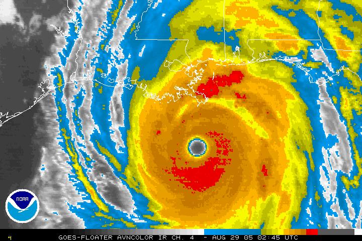
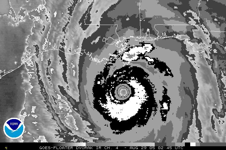
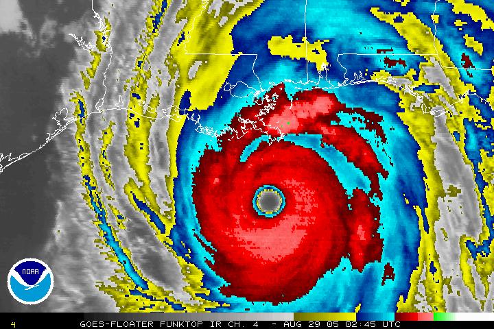
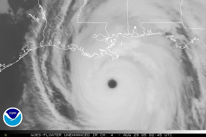
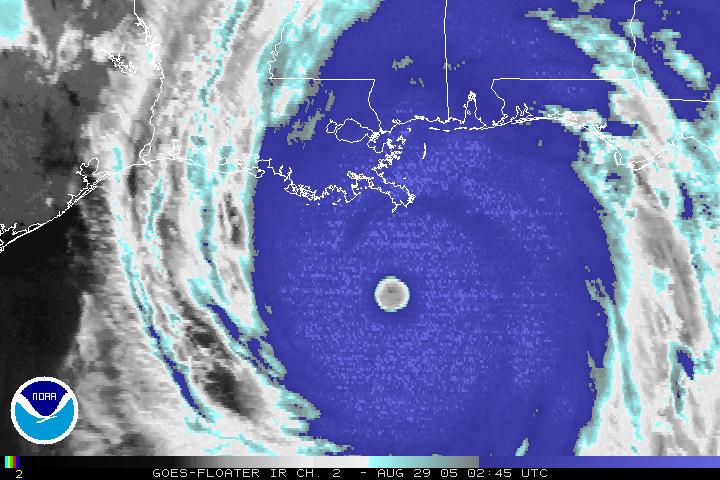
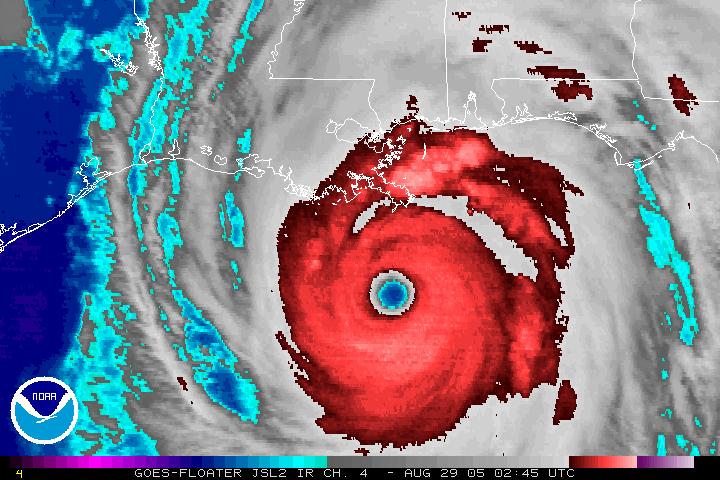
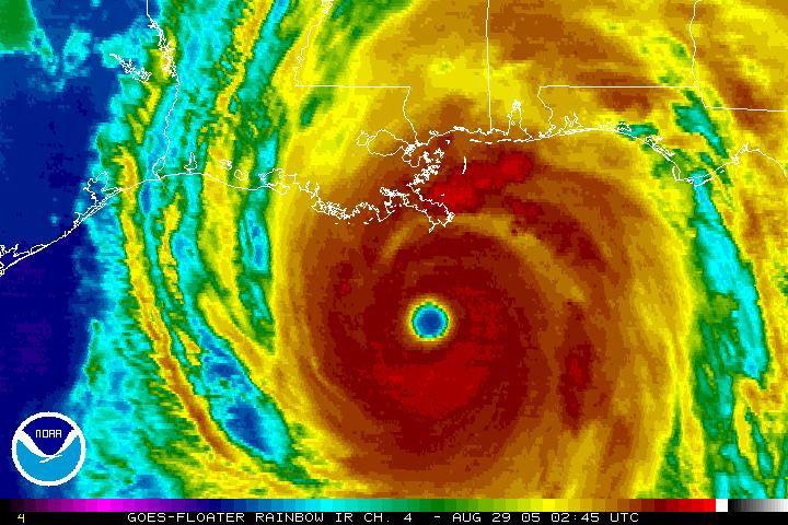
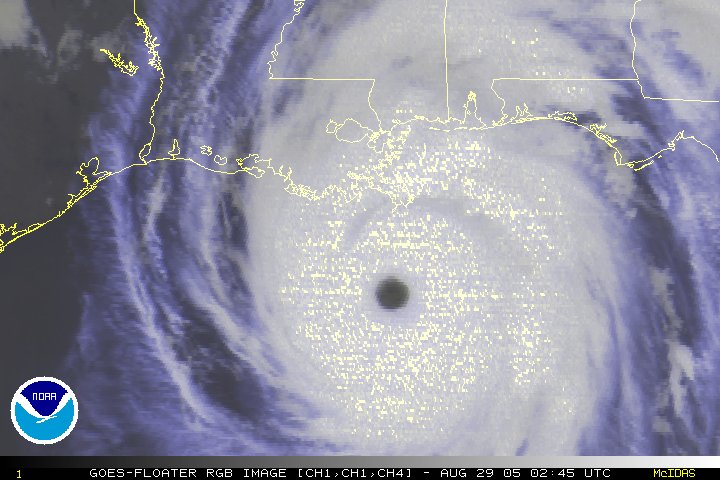
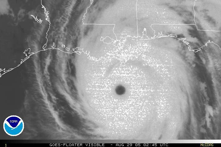
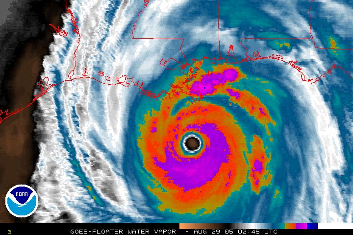
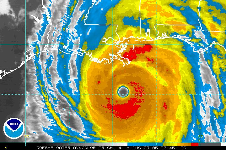
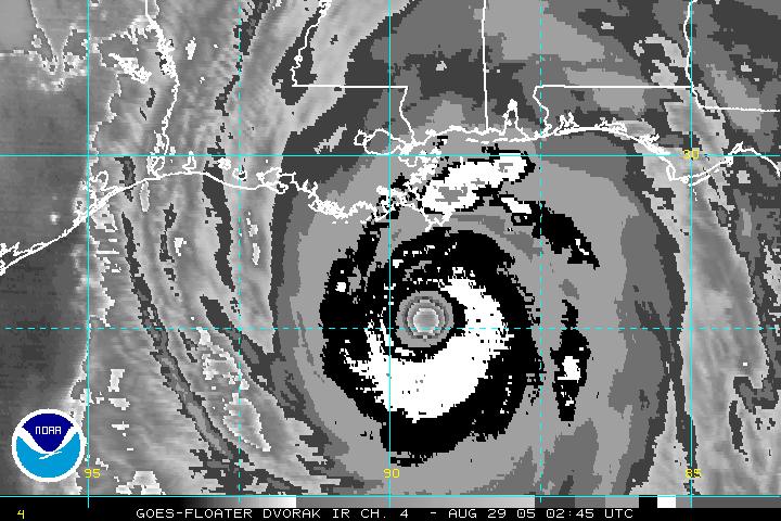
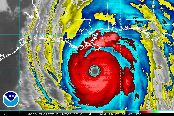
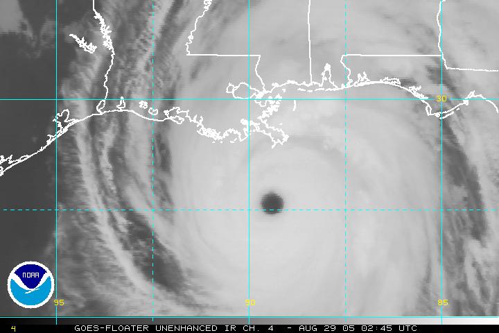
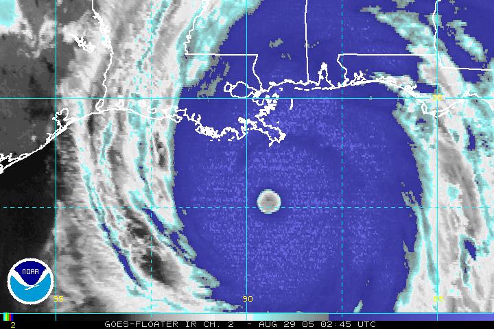
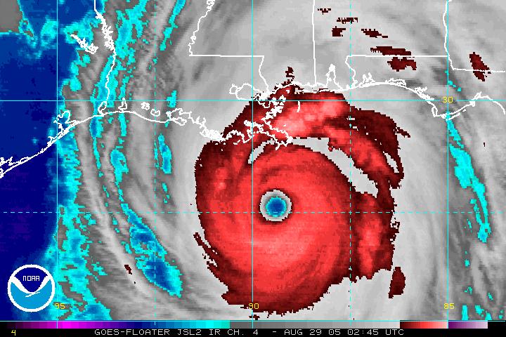
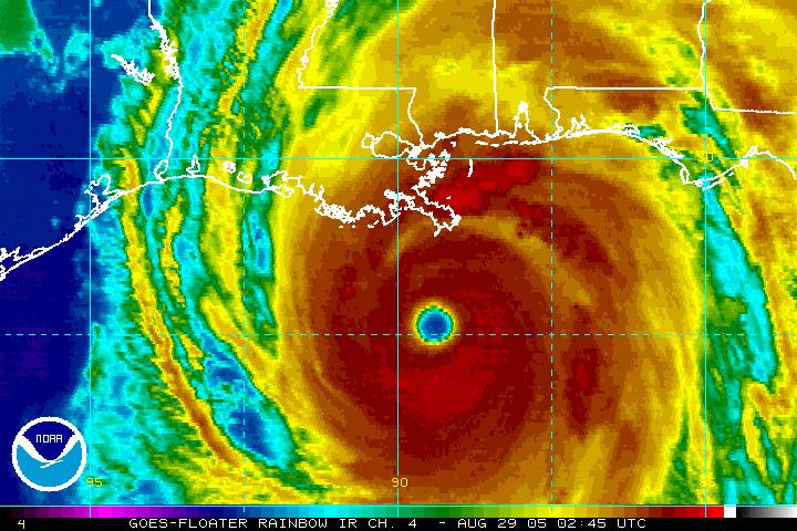
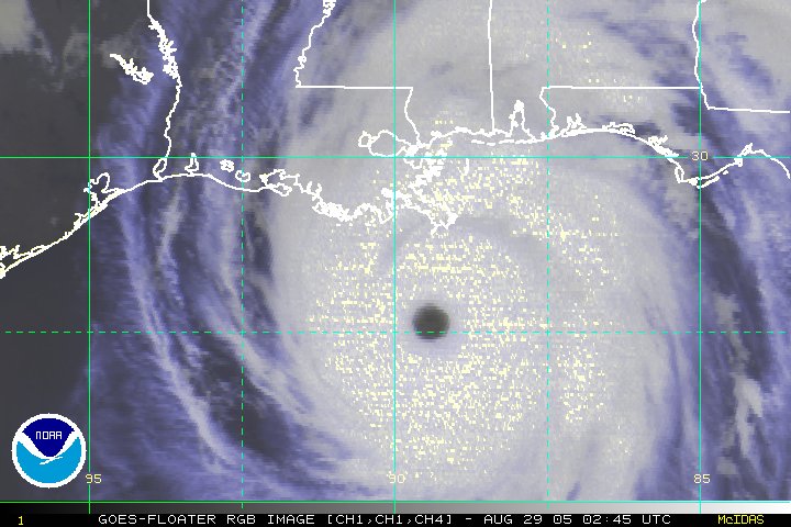
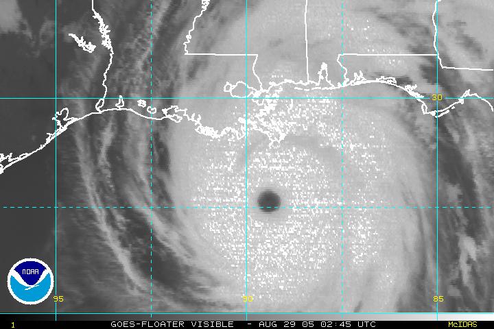
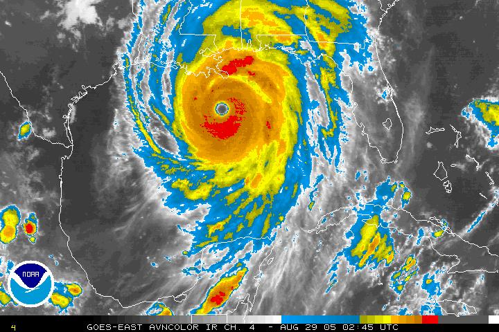
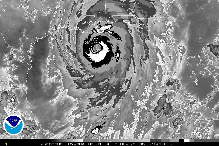
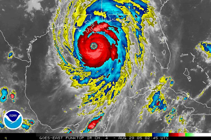
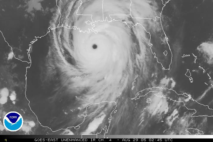
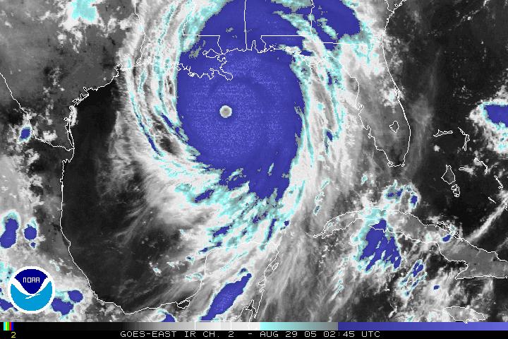
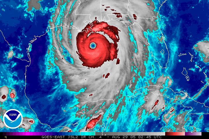
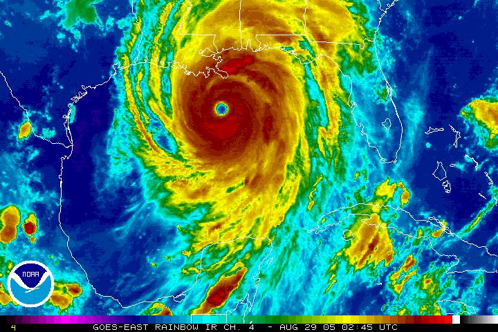
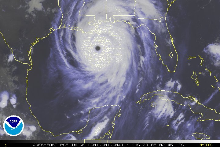
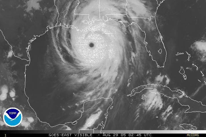
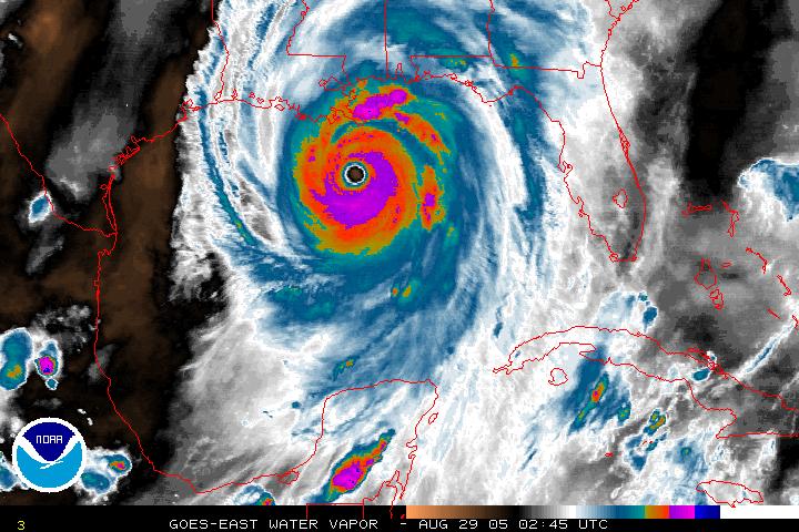
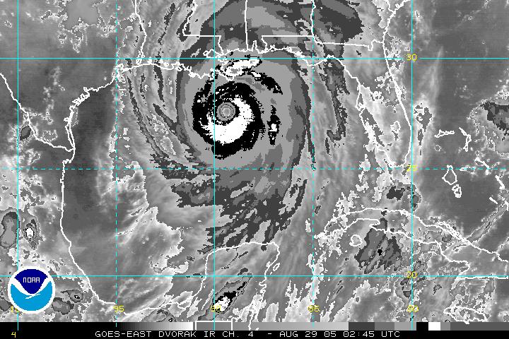
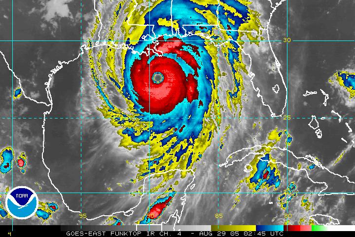
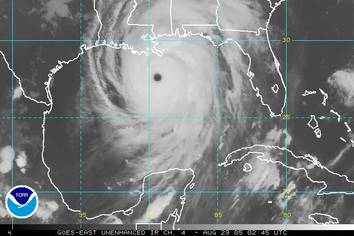
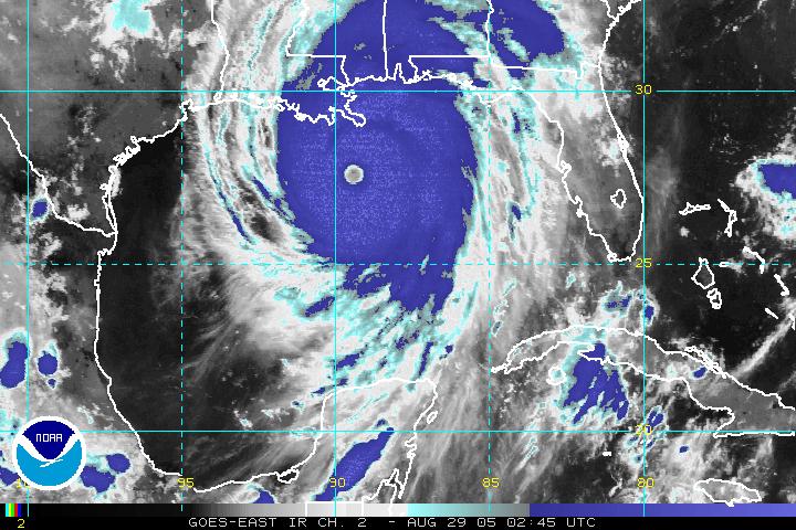
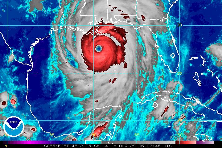
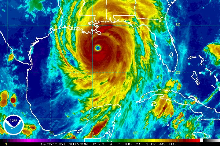
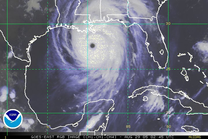
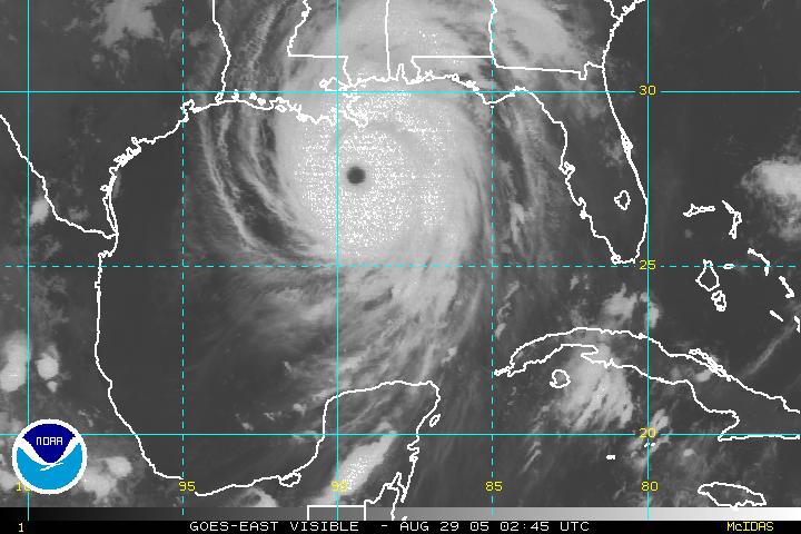
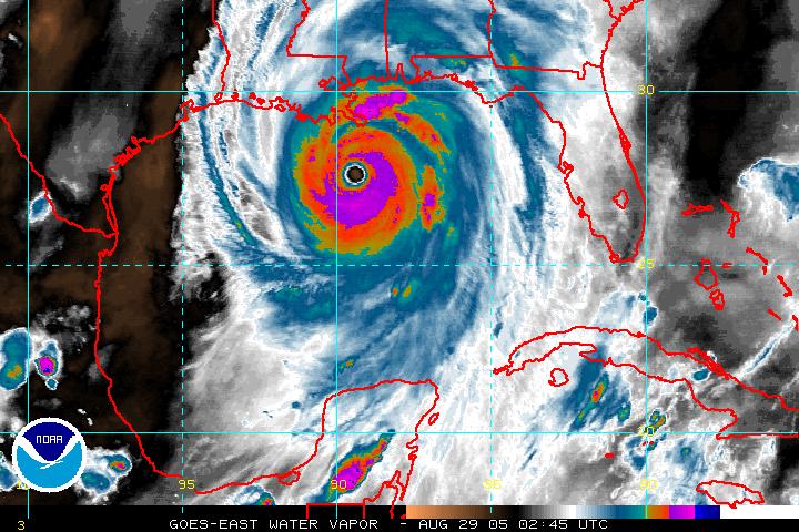
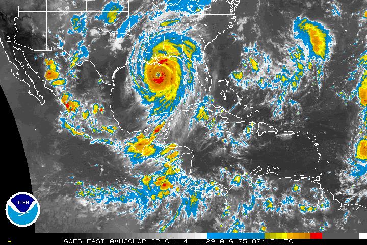
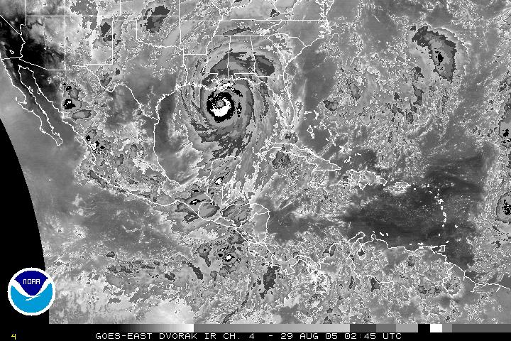
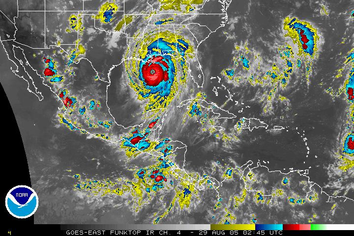
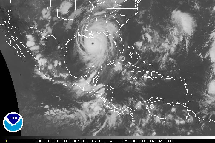
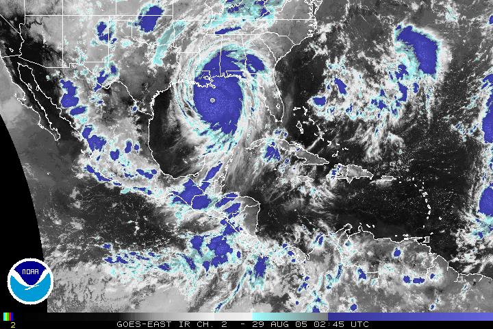
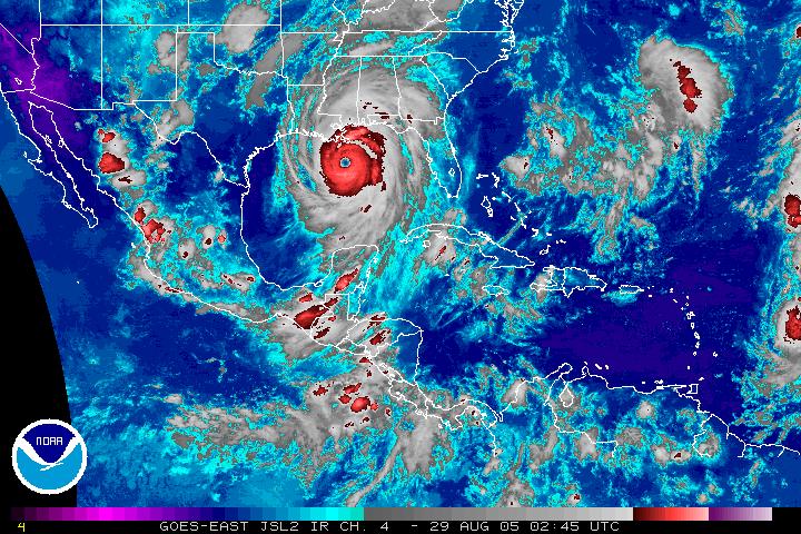
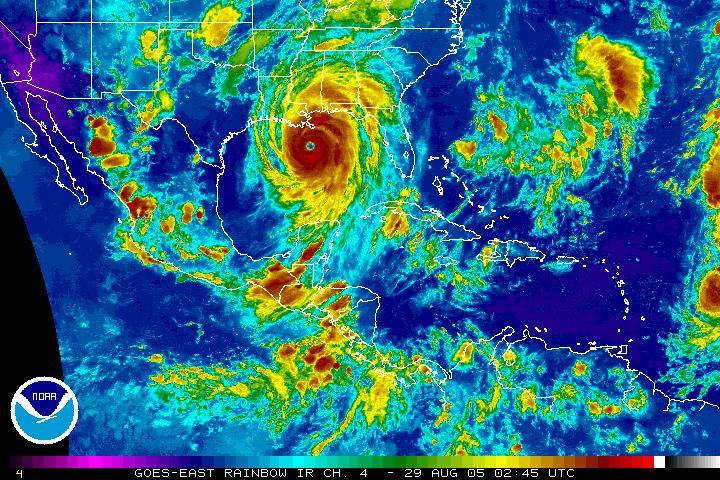
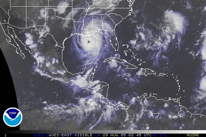
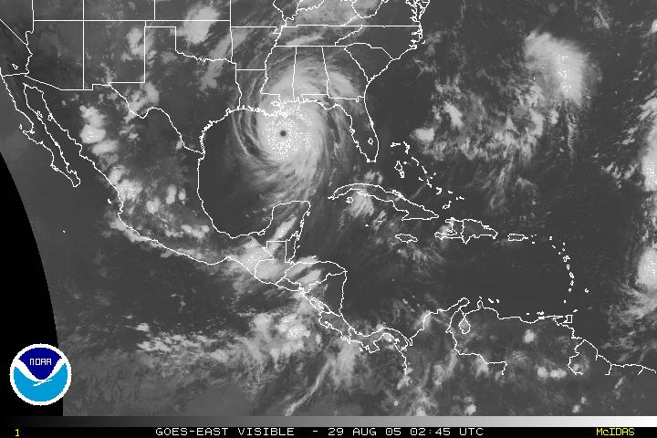
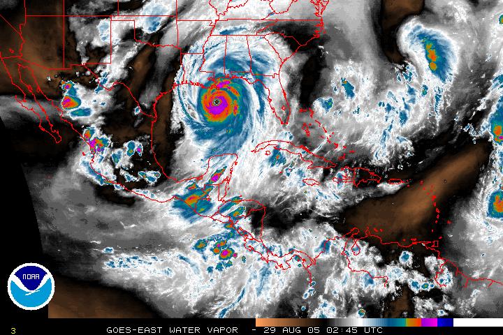
Images of Hurricane Katrina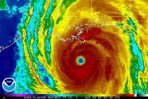 Hurricane Katrina, 02:45Z, August 29, 2005 – About 105 miles south of the mouth of the Mississippi River and about 170 miles south-southeast of New Orleans Louisiana.
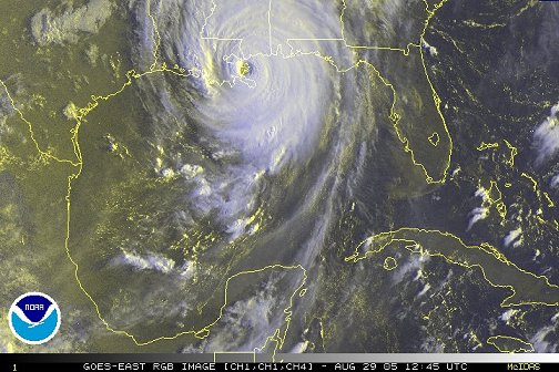
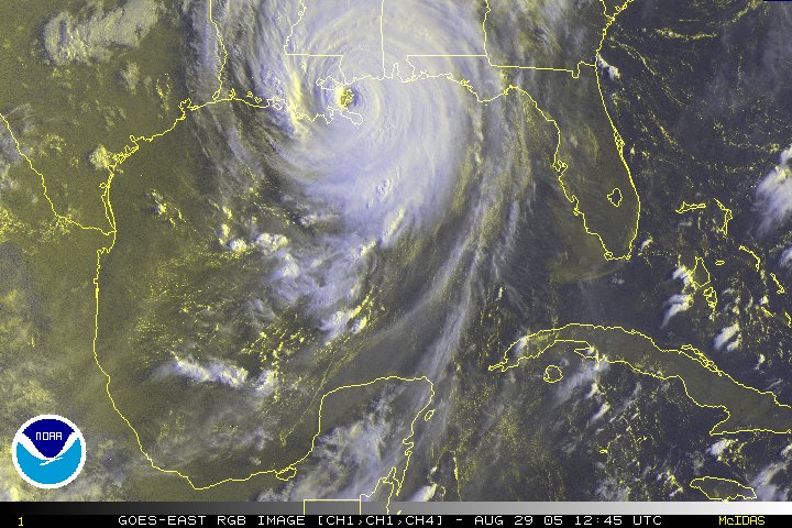
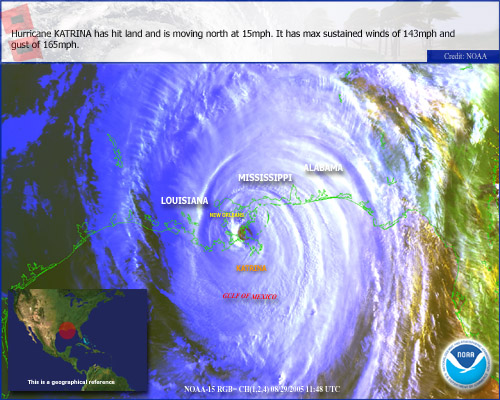
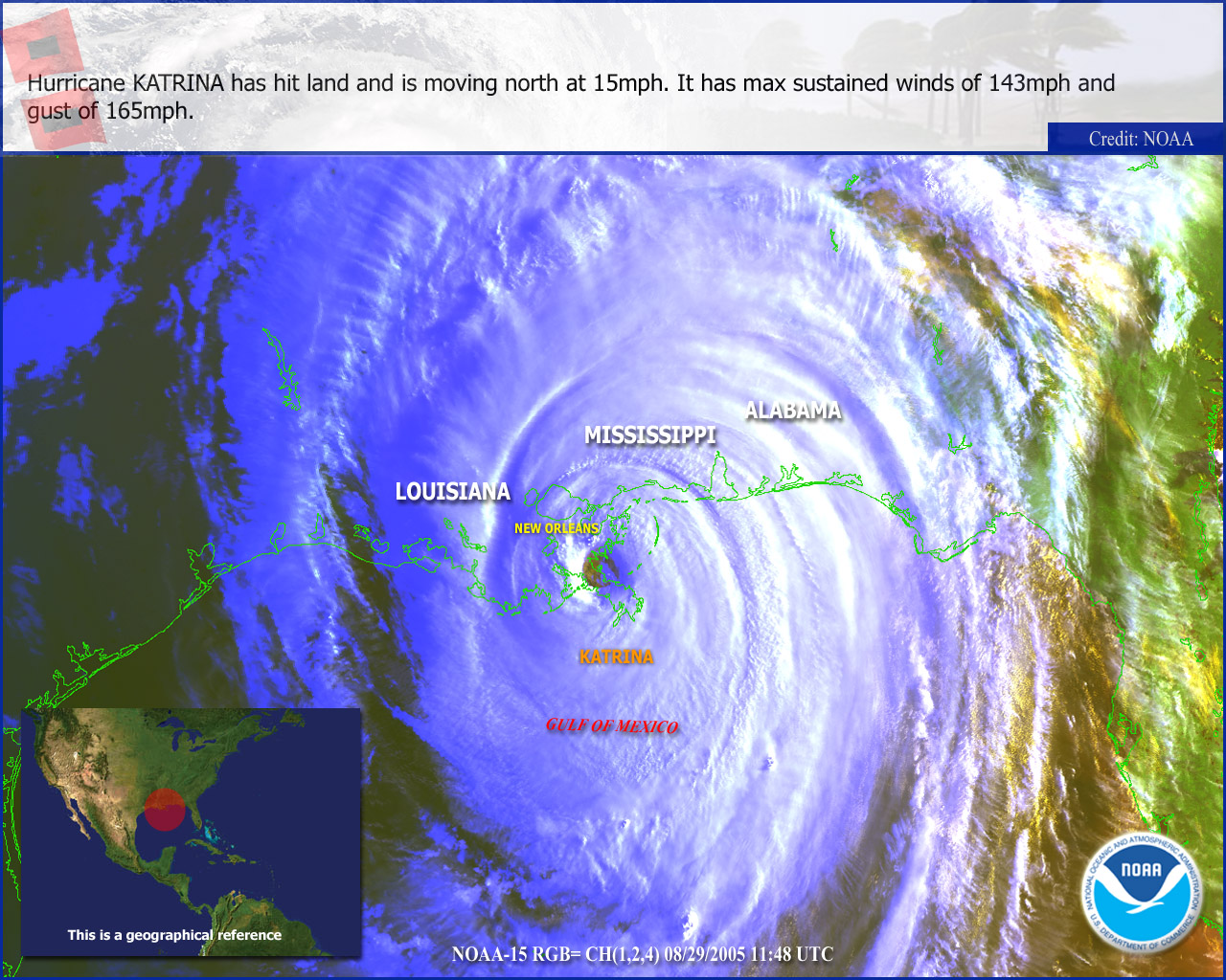
Hurricane Katrina, 12:45Z, August 29, 2005 – About 40 miles southeast of New Orleans Louisiana and about 65 miles southwest of Biloxi Mississippi.
Hurricane Katrina Operational Significant Event Images
National Hurricane Center Tropical Cyclone Report and Advisory Archive.
|
Floater Imagery Gulf Of Mexico Imagery Western Atlantic Imagery RSO Visible Loops Downloadable AVI Files Gulf Of Mexico Western Atlantic Tropical Rainfall Potential (TRaP) Rain Rate |