We're excited to announce that we've undergone a complete website redesign to enhance your browsing experience! Our fresh new look is designed to make navigation easier and content more accessible. Click here to be taken to the new OSPO homepage. Should you have any questions please reach out to the OSPO Webmaster.
All Satellites | Geostationary | Polar | Geostationary Satellite Server | NOAA Satellite Information System (NOAASIS)
| Bulletins and Notices | Operational Products General Satellite Messages Level 1B Notices Special Bulletins (NOAASIS) Special Bulletins (SPSD) Additional Satellite Information General Satellite Information Satellite Operations Control Center (SOCC) MODIS Status |
|
|
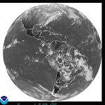
| GOES | Geostationary Operational Environmental Satellite (GOES) Overview Dissemination Schedules | Eclipse Schedules | Information and Links Office of Systems Development (OSD) - Home Page | GOES Page System Status Imagery in the . . . GOES-East Footprint | GOES-West Footprint What is a satellite "Footprint" Selected Image Links: Ocean Sectors: Atlantic | Pacific Regional U. S. Sectors: East | West WFO Sectors: East | West |
|
|
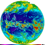
| HIMAWARI-8 | Japan Meteorological Agency (JMA) Satellite Center Satellite Page Imagery From the Japan Meteorological Agency (JMA) Full Disk Images Northern Pacific Countries/Islands (Guam and Micronesia) Southern Pacific Countries/Islands (Fiji, New Zealand, Vanuatu, etc) Pacific Ocean Sectors: West Central Pacific | West Pacific |
|
|
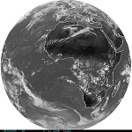
| Meteosat (EUMETSAT) | EUMETSAT Home Page Eclipse Schedules Imagery Full Disk Images |
|
|
| DMSP | Defense Meteorological Satellite Program (DMSP) Overview Ingest Logs |
|
|
| OSTM/Jason-2 | The Ocean Surface Topography Mission (OSTM) Home Page Implementation Satellite Operations Registration Help for Jason-2 Data from CLASS |
|
|
| MetOp | EUMETSAT User Notification Service (UNS) MetOp Home Page MetOp Satellite Operations |
|
|
| POES | Polar-orbiting Operational Environmental Satellite (POES) Overview Ingest Logs and Schedules Launch Schedule Pre-Processing Office of Systems Development (OSD) - Home Page | POES Page Joint Polar Satellite System (JPSS) System Status |
|
|
Additional Links: